
A working guide to the county, its communities, and what the listing photos leave out.
Daleville
Along Route 220 near I-81, and one of the county’s main residential and commercial areas. Housing runs from established neighborhoods through newer subdivisions, townhomes, and patio homes to larger lots as development gives way to countryside.
This is where much of the newer construction in the county is concentrated.
- I-81 and Route 220 within minutes
- Shopping, restaurants, and everyday services
- Newer subdivisions alongside longer-standing neighborhoods
- Townhomes and lower-maintenance housing
- Greenfield Recreation Park and the trail system
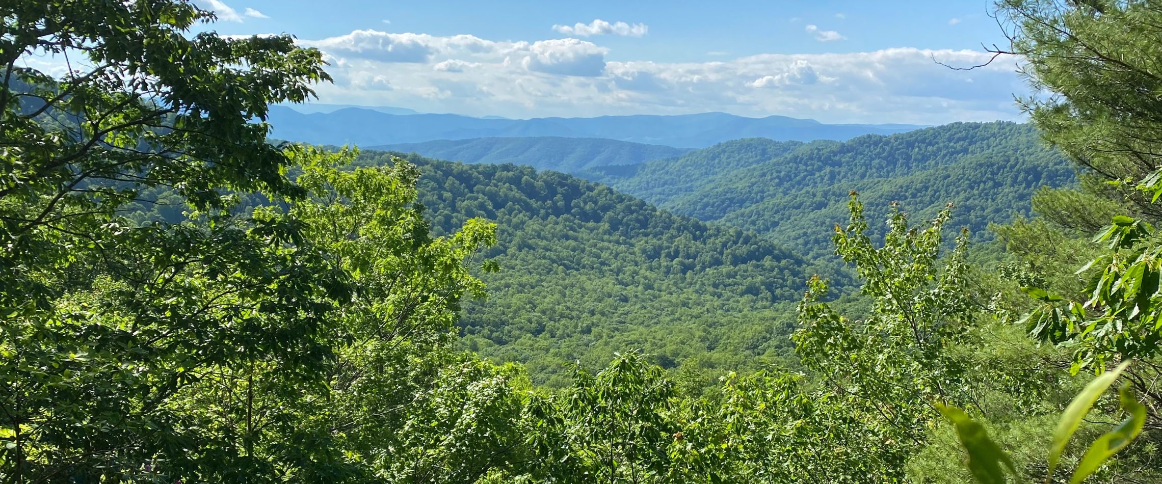
- Mountain views throughout
- Roughly twenty minutes to Roanoke
Troutville & Cloverdale
Between Daleville and Roanoke, and the closest parts of the county to the city. Neighborhoods, subdivisions, townhomes, and rural property with larger parcels toward the surrounding mountains.
- Direct I-81 access
- The shortest Botetourt commute to Roanoke
- Residential neighborhoods of varying eras
- Rural property and acreage in the surrounding areas
- Greenfield Recreation Park and trail system
- Blue Ridge views
- Shopping and services close by
Fincastle
The county seat, and one of Virginia’s older towns. A traditional street pattern and historic buildings at the center, with the surrounding countryside turning quickly to farms, wooded acreage, and mountain views.
Property here includes historic homes, traditional single-family houses, farms, acreage, and newer construction outside the town center.
- Historic town center and architecture
- Botetourt County Courthouse and government offices
- Traditional residential streets
- Farms and rural property surrounding the town
- Route 220
- Connections to Daleville, Buchanan, and Roanoke
Buchanan
Set on the James River, with a Main Street of buildings running from the early 1800s through the mid-twentieth century and the river passing directly through town.
Beyond downtown: traditional homes, farms, wooded acreage, mountain property, and rural land.
- Historic Main Street and the Buchanan Swinging Bridge
- The James River and Upper James River Water Trail
- Buchanan Town Park
- Appalachian Trail and Blue Ridge Parkway roughly four miles out
- George Washington and Jefferson National Forests
- Canoeing, kayaking, tubing, and fishing
Eagle Rock & northern Botetourt
Travel north and the county becomes markedly more rural and mountainous. Eagle Rock sits on the James in the northern end, a very different proposition from the southern corridor.
Property here runs to traditional homes, farms, wooded acreage, mountain land, riverfront, and larger rural tracts.
- James River access and river scenery
- Farms, wooded land, and acreage
- Fishing, paddling, and outdoor recreation
- National forest land nearby
- Craig Creek and surrounding recreation areas
Worth knowing before you look seriously up here: road access and who maintains it, wells and septic, topography, internet service, flood zones, and how far you actually are from services. None of it is a reason not to buy. All of it is a reason to ask early.
The James River
The river is one of the county’s defining features, running through Eagle Rock and Buchanan with public access points along the Upper James River Water Trail — paddling, fishing, tubing, and wildlife.
For anyone looking at river property, the same distinction applies here as at Smith Mountain Lake: riverfront, river access, river view, and near the river are four different things. They sound like variations on a theme and they aren’t.
Flood zone designation, elevation, access, insurance requirements, and property-specific restrictions all matter on waterfront, and all of them are worth establishing before you’re attached to a house.
Rural Botetourt & the agricultural landscape
Outside the towns and the Route 220 corridor, most of the county is rural. Orchards, pasture, hayfields, and working farms — apple orchards in particular are a recognizable part of the landscape, along with the seasonal farm stands and markets that come with them.
Property ranges from a few acres around a house to farms and substantial tracts of mountain or agricultural land:
- Homes with acreage
- Working farms and equestrian property
- Mountain homes and wooded recreational land
- Riverfront land
- Vacant building sites
- Hunting and recreational land
- Property with barns, workshops, and agricultural buildings
Two forty-acre properties a mile apart can be entirely different purchases.
Terrain changes substantially over short distances here, which means acreage alone tells you very little. Slope, road frontage, water resources, how much of it is actually usable, easements, septic suitability, and access all determine what a parcel can be used for.
Zoning, surveys, current land use, and any restrictions attached to the property are worth establishing early rather than late.
Outdoor access
The county’s geography puts a lot within reach — national forest, river corridors, mountain ridges, and public recreation areas.
- Appalachian Trail — crosses the mountains around the county, with well-known access near Daleville and Troutville and routes toward Tinker Cliffs and Hay Rock Overlook
- Blue Ridge Parkway — along the eastern mountains, with the usual scenic drives, hiking, camping, and overlooks
- Apple Orchard Falls — east of Buchanan in the Jefferson National Forest, a roughly 7.5-mile loop through mountain streams and cascades, rated moderately difficult
- Greenfield Trail System — including the Cherry Blossom Trail in Daleville, an accessible mile-plus loop for walking and cycling
- Roaring Run, Hoop Hole Trail, and Craig Creek Recreation Area
- Upper James River Water Trail — paddling and fishing access throughout
For a lot of buyers this is a genuine part of the decision rather than a nice extra. Worth being honest with yourself about whether you’ll use it, though — it’s an amenity you’re paying for in the price of being further out.
What surprises people
The county is long. Daleville and Eagle Rock are both Botetourt and have almost nothing in common — different terrain, different property types, and a substantially different drive to anywhere. Narrow by location as much as by property.
The commute is the trade. Southern Botetourt is genuinely close to Roanoke. North of Fincastle it stops being a commute and starts being a decision about how you want to live. Drive it at the hour you’d actually be driving it.
Acreage is not acreage. Slope and usable land matter more than the number on the listing, and the difference isn’t visible in photographs.
[Jennifer — two or three more in your own words. What do buyers get wrong about Botetourt? What do people moving up from Roanoke not expect? What do new-construction buyers find out later?]
Schools
Botetourt County Public Schools serves the county. Attendance zones can change, and the boundary isn’t always where people assume.
I don’t rate schools, and I’d be cautious about any agent who does. What I can do is tell you exactly which zone a specific address falls in, and point you to the division’s own reporting and Virginia Department of Education data so you can evaluate against what matters to your family.
Finding your place in Botetourt County
An unusual amount of variety within one county in the greater Roanoke region. You might be after:
- Newer construction close to Roanoke
- A traditional home in an established neighborhood
- A historic property in Fincastle or Buchanan
- A home with several acres
- A farm or equestrian property
- Mountain acreage
- Riverfront on the James
- A wooded retreat
- Land to build on
Rather than working out which Botetourt community is “best,” the more useful starting point is which property characteristics, location, price range, and acreage actually matter to you.
Tell me what you’re looking for and I’ll help you explore Daleville, Troutville, Cloverdale, Fincastle, Buchanan, Eagle Rock, and everything in between.
Have a question about a specific property?
Slope and usable acreage, wells and septic, road maintenance, easements, flood zone, what the zoning allows. Ask me something specific and I’ll give you a specific answer.
Equal Housing Opportunity
I provide real estate services in accordance with the Fair Housing Act and applicable federal, state, and local fair housing laws. Property searches and community information are based on objective criteria supplied by the client, including price, property characteristics, location, acreage, commute, proximity to amenities, waterfront status, and other housing-related preferences.